
Elections and Redistricting
The role of technology in the demarcation of constituencies.
Technology can be a very effective tool in the demarcation of electoral boundaries or the redistribution of constituency boundaries. Advanced mapping technology, such as geographic information systems (GIS), as well as database software, can be used by EMBs to assist in the demarcation process.
The demarcation of the electoral process can be divided into two categories: determining political boundaries (such as the boundaries of parliamentary constituencies), and defining administrative boundaries (such as the boundaries of polling sections).
Determination of political boundaries
Where political boundaries are defined, border distribution criteria often include a "one vote for one" element, as well as other non-objective criteria such as common interests, means of communication and physical space. The "one vote for one value" standard requires the EMB to ensure that the number of people or the number of registered voters residing in each department falls within a certain range.
The process of delimiting constituencies that contain specific numbers of people or voters can be very complex, especially where the tolerances for ideal quotas are limited. The process can be further complicated if it takes into account projected population growth. For example, for the Australian House of Representatives, the distribution of borders for 51 counties in NSW requires ensuring that the number of registered voters in each region is within 10% of the quota (or average number of voters in each district) at the time of distribution, The estimated number of registered voters residing in each region exceeds 3-5 years of quota.
Technology can be used in this process by tracking the number of people residing in each plot and by putting a number of people in the proposed areas consisting of groups of plots. The "sign and click" system in border demarcation allows EMB users to demarcate borders on computer maps, automatically calculating population numbers in each proposed district. This method provides a great deal of manual calculations compared to the "paper and pen" systems used in the past, allowing the EMB to explore more options than previously possible.
Technology can also be used to calculate population predictions where distributions require population growth rates to be considered.
Specify administrative boundaries
Administrative boundaries in general are limits that are not directly related to political representation based on the principle of "one vote, one value". It may include the boundaries of the voting divisions, which are subdivisions of parliamentary circles where individuals can vote. They can also include local government boundaries that are determined on the basis of geographical or spatial boundaries, rather than boundaries determined by population numbers, such as municipal councils.
Administrative boundaries do not tend to be strict in their requirement for certain numbers of residents in each region. Although the number of residents in each region is of less importance than the re-delineation of political circles, technology can still be used to delineate borders and print maps and other related products.

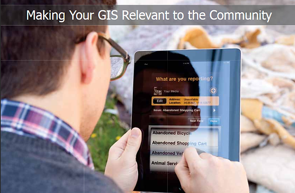
Put Esri technology at the heart of your successful elections and campaigns. In a rapidly changing world, take advantage of modern maps to effectively serve the public and meet expectations. From operations and public outreach to redistricting and campaigning, you empower your organization to create and deploy useful geospatial applications. Then visualize relationships, patterns, and trends to deeply understand your constituency and electoral process.


Negative and non-negative systems
It is possible to adjust the software to demarcate the border so that the border is automatically demarcated according to the applicable standards. This "passive" approach deprives humans of the decision-making process and relies on program instructions for a reasonable outcome. While the development of GIS software is increasing, the "negative" computerized distributions are unlikely to produce results without cash, except where the placement of the border is not significant.
Non-passive software allows the user to set limits, and the software performs calculations to determine whether the criteria have been met. This method is most commonly used because it allows users to draw logical boundaries by using their knowledge of this process.
Negative and non-negative systems can be combined so that the computer provides a starting point for users to deal with them as they see fit.
Applications of technology
Some examples of technology used for demarcation include:
- Access to relevant data, such as demographic, political and geographic data.
- Identification and treatment of census areas, or specific geographical areas used for census purposes
Work maps.
- The demarcation of the demarcation results and the results of the elections in the wake of changes in borders
- The use of geographic information systems to delimit the boundaries of the circuits.
- Use GIS to evaluate redistribution plans.
Deciding to use GIS in re-demarcation.
Countries considering the use of geographic information systems for demarcation should consider the advantages and disadvantages of introducing GIS. The reasons for the adoption of this system must be studied and clear objectives should be set.
Issues to be addressed include:
Expected benefits from the introduction of GIS
Improve the efficiency or effectiveness of the demarcation process
Availability of relevant maps
The costs of introducing GIS to redefine constituencies
Costs of obtaining additional maps
Potential users of GIS may find it useful to conduct a comprehensive cost and feasibility analysis to determine whether the expected benefits from the adoption of GIS to demarcate the constituencies justify the expected costs of implementing and maintaining the technology.
Costs and benefits of using GIS to redefine constituencies
Some of the direct costs that may be associated with the use of geographic information systems for redistricting include:
Acquisition of computer hardware and software
Acquisition of specially designed software
Maintenance and support of hardware and software
Maintain data, including creating, editing, and deleting data
Appoint qualified staff
Employee training
Some of the benefits that may result from the use of geographic information systems for redistricting include:
Save time when doing regular and repetitive tasks
Provide information faster
Provide a wider range of information
More accurate information
A new range of outputs - maps, reports, etc.
Improve the quality of demarcation decisions
Some costs and benefits, such as costs associated with purchasing GIS and time-saving benefits, are relatively easy to identify and estimate. However, other costs and benefits, especially indirect ones, are not easy to identify and estimate, but must be taken into account in the cost-benefit analysis.
The cost of using GIS to demarcate constituencies will vary widely depending on the availability of electronic data and on efforts to encrypt data if they are not available electronically. Where digital maps are available for the entire country or area under consideration, the costs associated with the adoption of GIS can be expected to be more moderate. On the other hand, if there is a need to create a database with digital maps, and the cost can not be shared with other governmental bodies or organizations, the effort and cost required may not be equal to the expected benefits from the use of GIS for demarcation purposes.
Choose a GIS software package
Once the decision is made that the expected benefits outweigh the costs, the next step is to choose the hardware and software for GIS.
Different options must be analyzed to determine which ones best meet the specific objectives. This includes determining whether software should be developed within the enterprise, purchasing a standard business package for geographic information systems, or purchasing and allocating a standard GIS software package (by hiring staff or consultants). Access to a privately owned GIS system will probably be cheaper, user-friendly and resource-supported, but may lack some of the specific functions required to practice the demarcation process.
Some aspects that should be taken into consideration in selecting the GIS software package include:
Hardware specifications required to run software (processor speed, memory, disk storage capacity, storage capacity)
The operating system required to run the program
Ease of use of software
Availability of documents, quality and languages
Availability of training
Center software supplier in the market (ensure continued development and support)
Availability and cost of software updates
Program functions
Ability of program functions to meet requirements
The extent to which software package customization is met for requirements
Software costs